3D Printing of terrain models
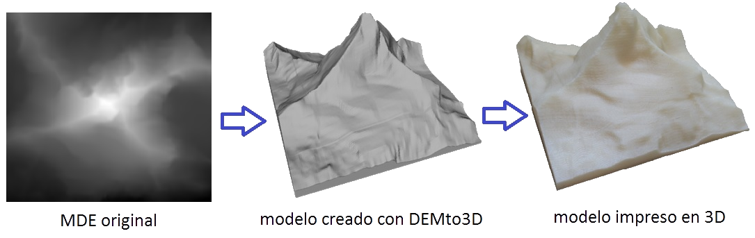
DEMto3D is the first tool that binds GIS (Geographic Information System) and 3D printing. This is an extension available for free and open source QGIS software, allowing DEM 3D printing (Digital elevation models).
In thingiverse, website where designs of pieces are shared to be 3D printed, you can find more models, made with this tool.
DEMto3D has been developed as part of the project:
“Development of a module for 3D printing digital elevation models based on low cost system“
of Engineering in geodesy and cartography of University of Jaén
Developed by: Francisco Javier Venceslá Simon